

Your Guide to Activities, Lodging, Dining, Shopping, Wine & More


Driving to Interstate 5 Through the Mendocino National Forest
Experience the Scenic Beauty of the Redwoods
Getting There
To reach Interstate 5 from Hwy 101, travel east on Hwy 162 north of Willits, past Covelo and through Mendocino National Forest. The journey is approximately 85 miles over both paved and dirt roads, and can take over three hours to drive, but the beautiful scenery and sweeping vistas will turn the chore of reaching the interstate into a delight. The route through Mendocino National Forest is usually closed until mid-May due to snow.
Closures are possible at other times of the year and road conditions may vary; for more information on conditions and closures before departing call the Covelo Ranger District at 707-983-6118 or the Grindstone Ranger District at 530-934-3316
More About Mendocino National Forest
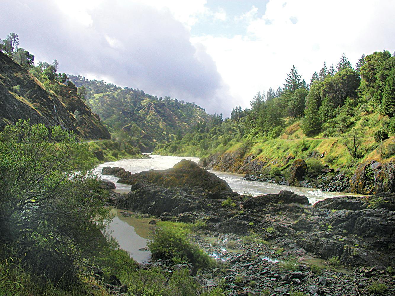
The Mendocino National Forest, just to the east of Covelo, covers an enormous area and is perfect for outdoor recreation. Of all of California’s 18 national forests, it is the only one that is not crossed by a paved road or highway. It is especially attractive when seeking tranquility and solitude.
Approximately 65 miles long and 35 miles across, Mendocino National Forest consists of one million acres of mountains and canyons that offer abundant recreational opportunities. Elevations in the forest range from 750 feet in the Grindstone Creek Canyon in the Sacramento Valley foothills on the forest’s eastern edge, to 8,092 feet at South Yolla Bolly Mountain in the northern part of the forest. The average elevation is about 4,000 feet. Four wilderness areas are located in the Mendocino National Forest: Yolla Bolly-Middle Eel, Yuki, Sanhedrin and Snow Mountain, running north to south respectively. The forest is also home to two federally designated Wild and Scenic Rivers: the Eel River received its designation in 1981, and the Black Butte River in 2006
Camping
The camping experience in Mendocino National Forest is outstanding, with developed campgrounds offering facilities from backcountry camping to dispersed campsites (which are not as developed as the regular campgrounds and will usually have one or two primitive vault toilets, one or two picnic tables and fire rings). For up-to-date information contact the Covelo Ranger Station located just north of Covelo on Hwy 162 or phone 707-983-6118.
Getting there is easy. Take Hwy 162 North of Covelo for 1.5 miles; there you will find the ranger station. From the station turn east on Hwy 162 for 11 miles to Eel River Work Center, where Hwy 162 arrives at the Mendocino National Forest. As the roadway enters the national forest it becomes Forest Hwy 7 (FH 7) and changes from a paved road to a dirt road. From there all the campsites are accessible. Some of our favorites are listed below.
Eel River Campground is adjacent to the Eel River Work Station with river access.
Hammerhorn Lake Campground is 18 miles north of Eel River Work Center via Road M1 (Indian Dick Rd.), and offers a 5-acre lake for trout fishing in a mixed conifer setting.
Little Doe Campground is 12 miles north of Eel River Work Center via Road M1 (Indian Dick Rd.). No piped water here, but a beautiful mixed conifer setting at 3,600 feet.
Howard Meadows Campground is great for picnicking with fishing and nearby boat launching ramp. At 3,500 feet this campground is within walking distance of Howard Lake.
Howard Lake Basin Recreation Area is a popular primitive experience. The 20-acre lake is accessible; however, it is recommended that vehicles with good clearance be used, such as a 4WD pickup truck, since the access road is not improved.
Several nicely dispersed camp sites include Atchison Camp on Forest Hwy 7, Section 24; Surveyor Camp, off Forest Hwy 7, 7 miles east of Eel River Station; Green Springs Camp and Rock Cabin Camp are trailhead camps and popular jumping off spots to the Yolla Bolly-Middle Eel Wilderness. Georges Valley and Soldier Ridge Camps are located at the northeast terminus of the Indian Dick Road. (M-1); both camps are at trail heads accessing the wilderness.
Recreation
The diverse geography of this forest offers numerous recreational opportunities, including hiking, backpacking, boating (no motors), fishing, hunting, nature study, photography, and off-highway vehicle travel. The Mendocino National Forest supports an extensive resident trout fishery as well as salmon and warm-water fisheries. Rainbow trout are found in over 300 miles of streams and 2,000 acres of lakes and ponds. The varied terrain of the Mendocino provides endless challenges for mountain bikers. Wilderness areas are one of the few places in the Forest where bicycles are not permitted. Mendocino National Forest offers one of the finest opportunities for OHV recreationists in Northern California, with designated routes and facilities. Free OHV maps are available at the Covelo Ranger station.